

Get set for a rare pre-Thanksgiving winter preview as a Nor'easter will bring a wintry mix of snow and sleet that will result in treacherous travel conditions during the Thursday evening commute.
After a mostly sunny day on Wednesday with a high temperature around 40, the chance for a wintry mix starts late in the morning Thursday on a day in which the high temperature will be in the mid-30s with the wind-chill factor making it feel like it's between 20 to 25.
The most treacherous conditions are expected Thursday afternoon and evening with slippery travel and reduced visibility as snow and sleet overspread the area starting at around 4 p.m. Thursday.
The wintry mix will continue for the entire region through around 11 p.m. Thursday before changing over to rain. Areas farther north will see freezing rain and some sleet and snow overnight through early morning.
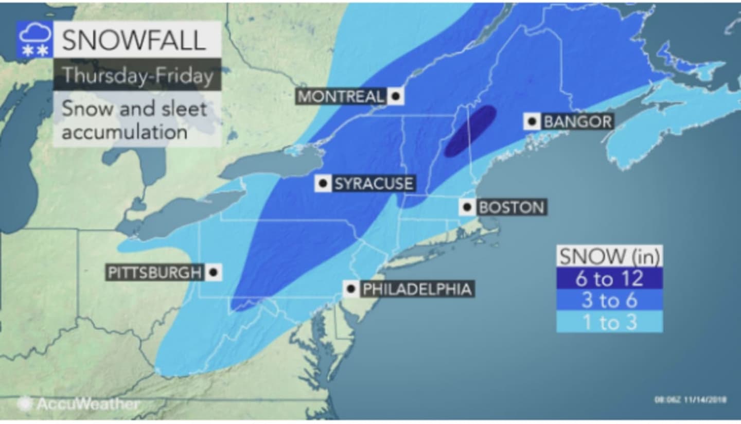
Areas farther south will see about an inch, or possibly 2 inches, of snow and sleet accumulation until the changeover to rain overnight. Up to 3 inches is possible north of I-84, where the snow chance lasts through around 10 a.m. Friday. Farther north and west, up to 6 inches is possible. (See first and second images above.)
The entire region will see rainfall late Friday morning into the early afternoon as the high temperature climbs into the mid-40s.
Saturday will be mostly sunny with a high in the mid-40s.
Check back to Daily Voice for updates.
Click here to follow Daily Voice Greenburgh and receive free news updates.